


Geocam Pro app for iPhone and iPad
Developer: Wazar LTD
First release : 10 Nov 2016
App size: 49.42 Mb
Geocam by Wazar is the leading geophoto and video application for smartphones. It uses augmented reality to show on top of your camera a layer of geographical information such as your compass orientation, GPS position and different phone inclinations like a theodolite optical instrument.
What you can do with Geocam:
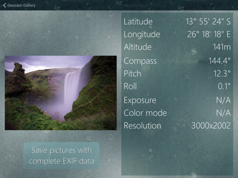
* Geo-Pictures: photos that have an extra layer of geographical data such as GPS position, compass orientation, pitch, roll, altitude, etc. This data is added into the EXIF metadata and can selectively be drawn on images as an overlay. You can see all you pictures on Google Maps or on Google Earth on your personal computer with the export feature. You can share those albums with anyone who can run Google Earth.
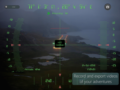
* Geo-Videos: the first and only app to let you record videos with an embed layer of geographical data. With Geocam Studio (available at geocam.wazar-apps.com), customize and export these videos to store or share them.
* Geo-Reports: Export your pictures to PDF files including a map, full bearings, comments
* Bearings: Geocam is an accurate measure tool. It shows your compass orientation (choose between magnetic or geographic North), your inclination and elevation with readable cursors (like a cockpit HUD). It can be used in terrain mapping, on a glide, sailing, mountain biking...
* Geo-Caching: prepare a list of key places in an area and view them with your camera on augmented reality: name, distance. You will not require a data connection offline so it can be used when hiking abroad, when visiting another city... This will help you make sure you are going in the right direction and give you remaining distance. You can also add markers during your hike with the "Add here" option, for example to flag the base camp, a water source, or anything interesting you find on your way.
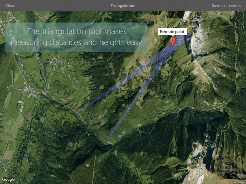
* Measurements: Evaluate the distance to any object with the triangulation feature. You can also measure its height once the distance is known. This is not done by showing any unreadable cursor on the screen, but with mathematical formulas. Choose between metric and imperial measure systems.
Geocam supports extensive customisation including:
* Selecting which indicators to display on the HUD and whether to save them or not on pictures
* Metric and imperial systems
* GPS Formats: Decimal degrees, degrees/minutes/second, MGRS, UTM
* True north or magnetic north
* Degrees or Mils compass readings
* Percentage or degree slopes
* Calibrating "zero" pitch and roll to custom values to measure differences
* Different themes including a "cockpit" style or a "hi-vis" style
Please note we do reply to all emails and regularly push out fixes to reported problems. By all means please do get in touch if you are experiencing difficulties.